The cave city of Eski-Kerman.
the time allotted for inspection tourist facility for 2-3 hours
Getting there
Sebastopol Simferopol or
- The electric train "Sevastopol-Simferopol" to reach the platform in 1509-km. Alley move on foot to the south in the direction of front-line villages. In this village, go across the river Belbek, turn left and head for the paved road on the south-east towards the village Holmovka. Distance - 3 miles. On the eastern outskirts Holmovki turn right and go south west on the paved road leading to an abandoned village Strong. Distance - 4.6 miles. Then get off the paved road, turn to a career onto a country that will take you to the foot of the northern tip of the plateau Eski-Kerman. Distance - 0.8 miles.
Sebastopol
- From the bus station of Sevastopol on the 5th kilometer of highway Balaklava a bus to the village Ternovka. At the bus stop Ternovca climb the steep path on foot to the pass between the peaks Shuldan Kaya and Chilter-kayak north of the village. Distance - 2.3 miles. From the saddle head north on the Kafka-tract Deresi (fifth beam), after which the above by poverty right and follow the marked walking trail on the west to the foot of the eastern end of the plateau Eski-Kerman. Distance - 2.7 miles.
- In the 14-kilometer highway Sevastopol - Yalta (M 18), turn left onto highway T May 1, and follow north through the village of Chernorechye, Turn-ku, Red Poppy. At the end of the village of Red Poppy, turn left and head toward the village Holmovka. Just before Holmovki, svernitenalevo on paved road, leading to an abandoned village Strong.
- Leave car at the barrier and then go on foot to the foot of the northern tip of the plateau Eski-Kerman.
Of Bakhchisarai
- From Bakhchisarai bus or bus North Sebastopol buses to the village of Red Poppy. From the bus stop move on foot to the south-west of the village on a dirt road that takes on an asphalted road. Turn left and follow the paved road, which soon turn onto a country that will take you to the foot of the northern tip of the plateau Eski-Kerman. Distance - 5.5 miles.
From Simferopol
- At the 39th kilometer of highway Simferopol - Sevastopol (M-26), turn left on highway Bakhchisarai to Yalta (T0117), paved the valley of the river Belbek. At the turn there is a monument to Soviet soldiers who fell in battles for Sevastopol during the Great Patriotic War. At the entrance to the village of Tank turn right on highway 05 T01. Follow it to the village of Red Poppy. When entering the village turn right and continue to move towards the village Holmovka. Just before Holmovki, turn left onto the paved road leading to the abandoned village of Strong.
- Leave car at the barrier and then go on foot to the foot of the northern tip of the plateau Eski-Kerman.
Sign in territory adjacent to the settlement, paid.
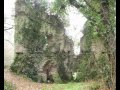
Cave town Eski-Kerman is located on the same plateau, which is a steep mountain dining. At the Eski-Kermen more than 350 known man-made caves. The territory of the fortress was built residential estates. Residents are largely dominated by viticulture, horticulture, gardening. Have been widely developed and crafts. During archaeological investigations here have been found tiles, pithoi, amphorae, dining and kitchen utensils.
Table Mountain - a mountain with flat tops and more or less steep, sometimes stepped slopes.
The fortress was built at the end of VI century. Initiated by the Byzantine Empire in the mountain Tavrika, it was intended to protect the northern approaches to the Black Sea outpost of the empire - Chersonese. In the 80 years of the VIII century fortress captured Khazars established their rule in south-western Crimea. Strengthening the newly passed under the authority of Byzantine administration only in the middle of IX century. In X - beginning of XI century began to acquire strengthening urban features. A XI-XIII centuries considered the heyday of the city.
Settlement was destroyed at the end of the XIII century. This event is associated with the campaign at the Golden Peninsula On Temnik Nogai.
Climb along the western slope of Mount Eski-Kerman road wheel on an ancient three-march, which leads to the main gate of the fortress.
Emphasis is placed on the deep ruts carved in the rock mass of the medieval wheel carts.
The last march of the road was covered with more defensive wall - proteyhizmoy. The space between the main and best represented the walls of a narrow stone corridor, with both sides locked gates. To get to the main entrance to the fortress, the attackers had to overcome this obstacle, it was almost impossible to do.
Last march along the road in a rock cut down a few buildings. Among them are the two churches. The first temple is located in the second tier of caves. Second, the so-called temple at the city gates, is located 25 meters from the first. At the entrance of the second temple carved out a small tub in which they washed their feet before entering the sacred place.
From the main gate of the city, punched in an array of rock, the main street of the city began, which led to the top of the mountain, where a spacious area of the basilica. Along the street in a rock cut down a few buildings. The caves at the entrance served as a shelter for the guards, or used for commercial purposes.
To the right of the gate in the eastern part of the rocks, cut down a large temple complex, which is a medieval Tatar population was called "tribunal".
After seeing the "tribunal," return to the main gate and walk on the rocky passage to the territory of the settlement. Then turn right and the trail in the bush walk to the eastern edge of the plateau. First on your way to meet a cave temple "Assumption," to which the edge of the plateau is a stone staircase. Originally, this room was used for household purposes and was converted into a church until the end of XIII - the beginning of XIV century. In the eastern corner of the temple is constructed altar. On the northeastern and western walls, ceiling and in the eastern corner of the traces of frescoes, dating from abroad XIII-XIV centuries. In the name of whom was consecrated by the church, is not known. The main plot of fresco - The Assumption of the Virgin - the church gave the code name, common perception today.

From the temple, "Assumption", follow the cliff along the eastern plateau. In the thick slabs of rock carved many artificial caves, ladders n transitions. These spaces are called casemates, because once they have defensive value. In the casemates were hiding defenders defending the cleft in which it was possible to climb to the plateau.
To the north-west of the excavated remains of the casemates housing. They are well-preserved lower rows masonry and rock cutting for household purposes.
From the site of excavation houses go down the path among the thickets in the north-west direction. The trail passes the ruins of residential settlement. In the middle quarters, the highest and widest point plateau, located basil. Today its ruins overgrown with trees and shrubs.
After inspecting the Basilica of the trail back to the eastern edge of the mound.
Move further to the north, after about 100 meters you will see at the very edge of a cliff a large rectangular hole - this is the entrance to the so-called siege well, which supplied water to residents of the Eski-Kerman.
Eski-leaguer Kermensky well - a big waterworks. In the interior of the rock carved steep stairs going down shestimarshevaya. It is located at a depth of 30 meters horizontal catchment gallery, which in former times was filled with pure water from underground sources. Of drinking water in the basin is 70-75 cu. In the middle of first march is a large artificial cave with a door opening. She served as a refuge for the guards guarding the entrance to the vital subject. Between flights of stairs constructed a small platform where the divorce could easily occur waterboy.
50 meters north of the well shaft is low - the remains of the wall that separated the Middle Ages built up a vast part of the city of wasteland in the northern part of the plateau. Turning a vacant lot, starting behind the wall, you arrive at the northern extremity of the settlement, where the northern patrol the complex. To get there, you descend a narrow cleft in the steep ledge of it to go down the path to the saddle. On the opposite side of her scrub mask the entrance to the cave.
In the south-eastern slope of the plateau Eski-Kerman, overseas territory of the fortified city, is another interesting site - the Temple of the "Three horse." The temple is carved into the rock loose from the massive boulder. In the eastern part of the church between the stone pillars once stood a wooden iconostasis. On the north wall can be seen frescoes depicting the three holy warriors of the martyrs. From her temple and got his code name. The temple dates from the XII century, at the same time (or at the beginning of the XIII century) was carried out and painting.
Fisherman's Village "Black Stones"
District and village Holmovka Red Poppy
Tel. +38 0652 583305 (in Simferopol)
mob. +38 050 6528928, +38 095 8445141
At your service two ponds with fish, comfortable cottages, restaurant, parking, set for trap shooting and hunting sports.